Mountain Melodies - Live Music every Sunday dinner from October 12th to December 14th Book Now!
Hiking and Sightseeing
Discover some of the best hikes and viewpoints in Kananaskis, from short and easy family-friendly and dog-friendly hikes, to challenging hikes for adventure-seekers.
Top Kananaskis Hikes & Scenic Viewpoints
Escape from the busy trails of Banff and Canmore, and discover the scenic trails of Kananaskis. This guide highlights some of Kananaskis’ best hikes and viewpoints, featuring turquoise lakes, tumbling waterfalls, golden larches, and wildflower-filled alpine meadows with stunning Rocky Mountain backdrops. All of these hikes are easily accessible from Mount Engadine Lodge—your perfect year-round adventure basecamp. While the Kananaskis hiking season peaks in June to October, hiking and nature walks can be enjoyed throughout the year in Kananaskis, especially with the help of snowshoes and spikes for winter hiking!
From the best short, easy hikes and viewpoints, a wide range of moderate family-friendly and dog-friendly hikes, plus more challenging hikes like Tent Ridge, this Kananaskis hiking guide has something for everyone.
Please note that the distances, elevation gain, and average time are approximate, and difficulty is subjective. We have included some helpful tips for hiking in Kananaskis and encourage you to do your own research as well.
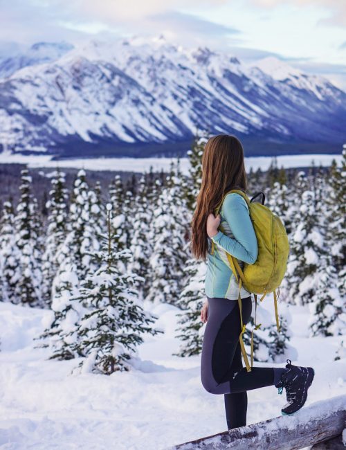
Rummel Lake
- Difficulty: Moderate
- Round-Trip Distance: 10 km
- Average Time: 3.5 hrs
- Elevation Gain: 430 m
- Route Type: Out & back
- Key Features: Alpine lake, family-friendly, dog-friendly, larch trees, snowshoeing & winter hiking, cross-country skiing, fishing
- Drive from Mount Engadine: 0 mins
Rummel Lake is a must-do hike in Spray Valley Provincial Park, conveniently located just steps from Mount Engadine Lodge. This moderate 10 km round-trip hike offers a rewarding journey with an initial 1.5 km uphill climb, followed by a more gradual incline through serene forested terrain. Along the way, you’ll enjoy sweeping views of the Spray Lakes and surrounding peaks. The trail culminates at the stunning Rummel Lake, nestled beneath Mount Galatea, with crystal-clear turquoise waters and breathtaking alpine scenery. This family-friendly and dog-friendly hike is especially popular in the fall, when the golden larch trees create a picturesque landscape, and is often less busy than other larch hikes in the area. Rummel Lake is accessible in winter with a well tracked snowshoe trail.

Mount Engadine Meadows
- Difficulty: Easy
- Round-Trip Distance: 100 – 200m
- Average Time: 20min
- Elevation Gain: 0 m
- Route Type: Varies
- Key Features: Creek, alpine meadow, wildflowers, family-friendly, dog-friendly, snowshoeing, cross-country skiing
- Drive from Mount Engadine: 0 mins
Nestled in the backcountry of Kananaskis’ Spray Valley, Mount Engadine Lodge is surrounded by breathtaking wilderness, including the picturesque meadow behind the lodge. In summer, access to the meadow is limited with trails that will take you down to the wooden platform and to the creeks edge where you can relax and enjoy the flowing water, wildflowers and serene surroundings, but no further as this area is environmentally sensitive. In winter, once the creek freezes and the valley fills up with snow, it becomes a great spot to enjoy snowshoeing and cross-country skiing on a sunny day. Click here to see the Mount Engadine Ski & Hike Loop trail map.
Whether you’re wandering the meadows or soaking in the views from the patio or your room, you can truly relax and savour the experience. Afterward, enjoy a delicious meal at our mountain-view restaurant, open to guests and day visitors with reservations.
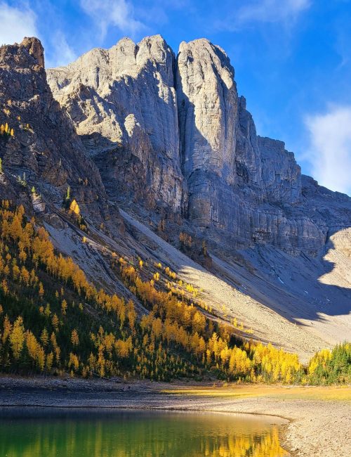
Tryst Lake
- Difficulty: Moderate
- Round-Trip Distance: 7 km
- Average Time: 2.5 hrs
- Elevation Gain: 350 m
- Route Type: Out & back
- Key Features: Lake view, dog-friendly, family-friendly, larch trees, snowshoeing, less crowded
- Drive from Mount Engadine: 1 min
Just moments away from Mount Engadine Lodge, the Tryst Lake hike is one of the least busy trails in the area, offering a peaceful and rewarding experience. It’s especially popular in the fall when the golden larch trees along the ridge reach their peak around late September to mid October, reflecting beautifully off the lake on a calm day. For a more secluded experience, head to the end of the lake, where you’ll find a dense grove of larches—an ideal spot for a lunch break. Adventurous hikers can extend their day by taking the trail up to the ridge, offering elevated views of the lake and even glimpses of Mount Engadine Lodge. In the winter, Tryst Lake transforms into a serene snowshoeing trail, perfect for those looking to explore a quiet, snowy landscape.
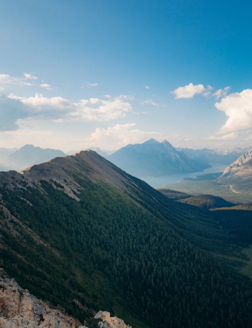
Tent Ridge
- Difficulty: Challenging
- Round-Trip Distance: 10 km
- Average Time: 4-6 hrs
- Elevation Gain: 831 m
- Route Type: Loop
- Key Features: Lake view, ridge walk, scramble, larch trees
- Drive from Mount Engadine: 3 mins
For those seeking a challenging adventure with breathtaking views of Spray Valley, Tent Ridge is a perfect choice. This hike involves light scrambling and steep elevation gains, culminating in an exhilarating walk around the horseshoe ridge. Renowned as one of the best ridge walks in the Canadian Rockies, it offers incredible views of Spray Lakes and Mount Assiniboine, along with a vibrant sea of golden larch trees in the fall. The trail features minimal exposure, reducing risks for hikers, although those who are wary of heights may find it challenging. To make the trek easier, approach the ridge clockwise to minimize the steep terrain. Additionally, hiking this trail in winter is discouraged because of avalanche risks. The optimal time to experience Tent Ridge is between June to October.
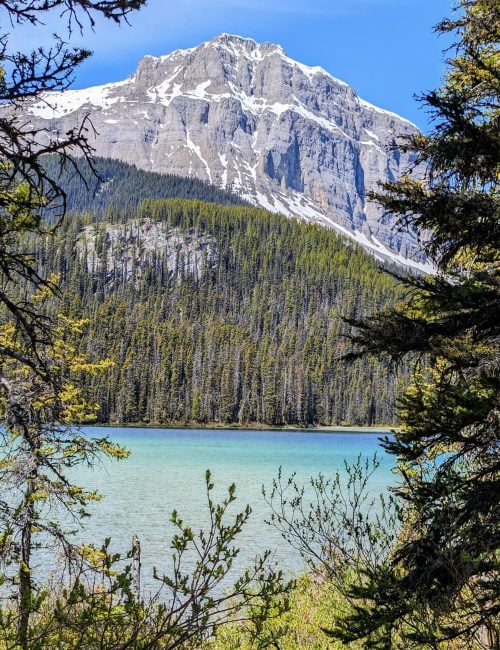
Watridge Lake & Karst Spring (Mount Shark)
- Difficulty: Moderate
- Round-Trip Distance: 8 km Watridge Lake, 10km Karst Spring
- Average Time: 2 hrs Watridge Lake, 2.5-3 hrs Karst Spring
- Elevation Gain: 180 m Watridge Lake, 300 m Karst Spring
- Route Type: Out & back
- Key Features: Alpine lake, waterfall, family-friendly, dog-friendly, mountain biking, cross-country skiing, snowshoeing & winter hiking, swimming, fishing
- Drive from Mount Engadine: 5 mins
Beginner and family friendly, the Watridge Lake & Karst Spring hike follows along an old logging road through the heart of the Mount Shark Cross-Country Ski network. The trail to Watridge Lake is well marked, relatively flat, and is double wide the whole way, suitable for hiking and mountain biking, as well as cross-country skiing and snowshoeing in the winter. After enjoying the beautiful mountain, forest, and river views along the trail, you arrive at the lake that sits below picturesque mountain peaks. On a hot day, a swim in the lake is highly recommended for those willing to brave the chilly waters. At the lake, you will see the sign and trail to continue on to Karst Spring. This section of the trail is narrow and steeper as you make your way to the Spring, but it is not too much further and well worth the extra effort. At the Spring, you will see where the water seemingly comes right out of the mountain.

Chester Lake
- Difficulty: Moderate
- Round-Trip Distance: 10 km
- Average Time: 3 hrs
- Elevation Gain: 419 m
- Route Type: Out & back
- Key Features: Alpine lake, alpine meadow, wildflowers, family-friendly, dog-friendly, larch trees, fishing, winter hiking & snowshoeing, cross-country skiing
- Drive from Mount Engadine: 10 mins
Chester Lake trail is an easy to moderate hike, stretching approximately 10 km, leading to a beautiful alpine lake that serves as one of the most scenic lunch spots in Kananaskis. This trail is popular year-round, offering vibrant wildflowers in the summer, stunning golden larches in the fall, and snow-covered landscapes perfect for snowshoeing or crampon hiking in the winter. For those with extra energy, the trail continues beyond Chester Lake to Elephant Rocks and then on to another lake, with the surrounding peaks providing breathtaking views. In the fall, the larch trees are especially spectacular, particularly if you continue towards Elephant Rocks and beyond.
Burstall Pass
- Difficulty: Easy-Moderate
- Round-Trip Distance: 16 km
- Average Time: 5 hrs
- Elevation Gain: 650 m
- Route Type: Out & back
- Key Features: Alpine lake, creeks, alpine meadow, wildflowers, family-friendly, dog-friendly, larch trees, mountain biking
- Drive from Mount Engadine: 10 mins
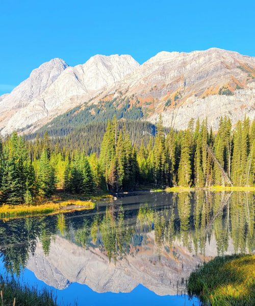
One of the longer hikes near Mount Engadine Lodge, the Burstall Pass trail makes you work for the views – but it’s worth it. Once you arrive at the top of the pass and gaze back at the trail you just conquered, the view is one of the best in Kananaskis. This is a great option for those looking to spend a little extra time outside while still enjoying an easy to moderate trail. You’ll pass stunning lakes and creeks, alpine meadows full of wildflowers in mid summer, and golden larch trees in the fall. You also have the option of biking the first section of this trail, and there is a bike rack to lock up your bike at the point where bikes are no longer permitted. The best time to hike Burstall Pass is between June to October, and it is not recommended in the winter due to avalanche risk.
Spray Lakes
- Difficulty: Varies
- Round-Trip Distance: Varies
- Average Time: Varies
- Elevation Gain: Varies
- Route Type: Varies
- Key Features: Alpine lake, boating, fishing, mountain biking, family-friendly, dog-friendly
- Drive from Mount Engadine: 15 mins
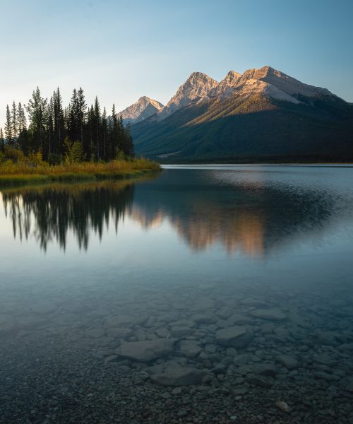
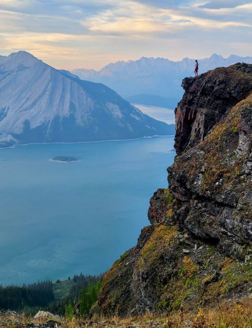
Stop by Spray Lakes for a stunning view at any time of year. With hiking and mountain biking trails, plus fishing and boating, there is no shortage of adventure at Spray Lakes. Long and narrow, Spray Lakes is the largest lake in Kananaskis. The lake is popular for fishing in both summer and winter. Power boats are permitted in summer with a boat launch available at Driftwood Day Use Area. The best view of the lake is from above. If you try any of the hiking trails along the lake, you will be treated to breathtaking views of the stunning blue lake wrapping around the mountains.
West Wind Pass
- Difficulty: Moderate
- Round-Trip Distance: 4.5 km
- Average Time: 2 hrs
- Elevation Gain: 350 m
- Route Type: Out & back
- Key Features: Lake view, dog-friendly, family-friendly
- Drive from Mount Engadine: 20 mins
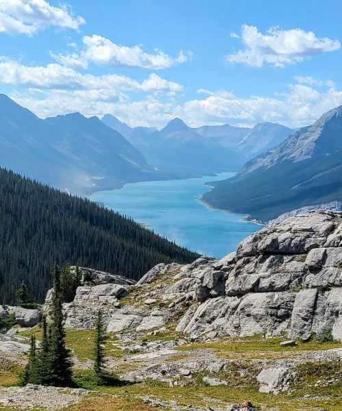
West Wind Pass is a fantastic hike for those seeking an easy to moderate challenge with breathtaking views. Spanning approximately 4.5 km, this trail attracts adventurers of all ages. The stunning vistas, particularly of Spray Lakes, become increasingly spectacular as you ascend. For those with more experience, this trail serves as the starting point for the more demanding Rimwall and Windtower hikes, which involve greater distance and elevation gain. As the name implies, West Wind Pass can be quite breezy, so it’s wise to pack extra layers and check the weather forecast before heading out. The best time to hike West Wind Pass is in the summer after the snow melts in late June.
Blackshale Suspension Bridge
- Difficulty: Easy
- Round-Trip Distance: 1 km
- Average Time: 30 mins
- Elevation Gain: 60 m
- Route Type: Out & back
- Key Features: Suspension bridge, family-friendly, dog-friendly, mountain-biking
- Drive from Mount Engadine: 30 mins
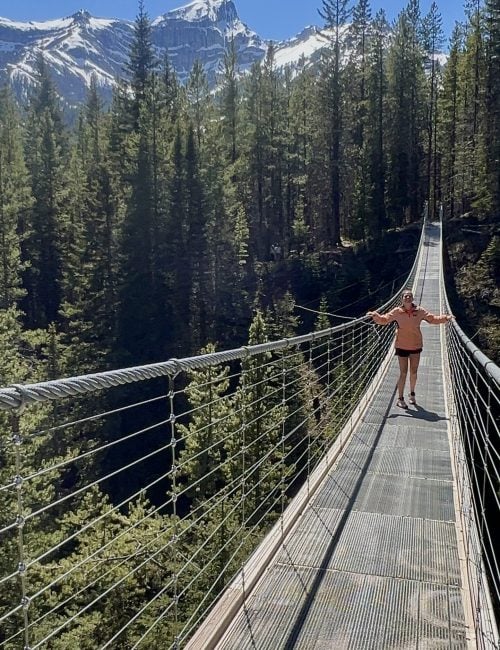
One of the most popular viewpoints and photo spots around Mount Engadine Lodge, Blackshale Suspension Bridge is a short 1km loop that takes you up to the suspension bridge and back down in about 30 minutes. This spot can get busy, so its best to start or end your day with a visit here to avoid the crowds. Those hiking or biking on the High Rockies Trail may also come across this location on their trip. The bridge closes in the winter and spring when snow levels are high, and closure dates vary from year to year, so check the Alberta Parks Advisory Page for Peter Lougheed Provincial Park before you head out.
Kananaskis Lakes
- Difficulty: Easy
- Round-Trip Distance: 3km Sarrail Falls, 16km Upper Kananaskis Trail
- Average Time: 0.5 hrs Sarrail Falls, 3.5 hrs Upper Kananaskis Trail
- Elevation Gain: 0 m
- Route Type: Loop
- Key Features: Alpine lake, waterfall, snowshoeing, family-friendly, dog-friendly
- Drive from Mount Engadine: 50 mins
Located 40km from Mount Engadine Lodge, the Kananaskis Lakes area has everything you could want, with stunning views right from the parking lot. The lake is perfect for canoeing, kayaking, paddle boarding and is one of the best picnic spots. There is also a 16km walking trail (Upper Kananaskis Lake Trail) that has very little elevation change as you enjoy the lake, mountain, and waterfall views along the way. This trail can be enjoyed in both the summer as well as in the winter with snowshoes. Just 1.5 km into Upper Kananaskis Lake Trail, after a scenic walk alongside the lake, you’ll come across the beautiful Sarrail Falls. From there you can finish the loop, continue onto the more challenging Rawson Lake hike, or just turn around and call it a day! There are also excellent hiking options here, with the trail to Rawson Lake and Sarrail Ridge attracting many hikers each season.
Rawson Lake
- Difficulty: Moderate
- Round-Trip Distance: 7 km
- Average Time: 3 hrs
- Elevation Gain: 526 m
- Route Type: Out & back
- Key Features: Alpine lake, waterfall, family-friendly, dog-friendly, fishing, snowshoeing & winter hiking
- Drive from Mount Engadine: 50 mins
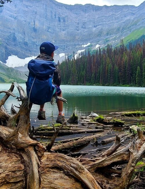
Rawson Lake trail is a moderately challenging hike beginning from the Upper Kananaskis Lake day use area. The trail starts off relatively flat and easy family-friendly hike, passing alongside the lake and over the scenic Sarrail Falls, only about 1.5km from the parking lot. From there, you start you ascend through mossy forest on relatively steep and rocky switchbacks. While this section can be slightly tricky, with a bit of patience it is manageable for even beginner hikers. After reaching Rawson Lake, more daring and adventurous hikers can continue up to Sarrail Ridge for a challenging ascent that’s rewarded with panoramic mountain views.
The Best Short, Easy Hikes & Viewpoints
If you’re short on time or prefer a more leisurely outing, Kananaskis offers a variety of quick and easy hikes and viewpoints that showcase stunning landscapes without the strenuous hike. These accessible scenic spots provide breathtaking vistas, perfect for families, non-hikers, or anyone looking to soak in the beauty of the Canadian Rockies.
- Blackshale Suspension Bridge: This easily accessible suspension bridge offers a thrilling experience and spectacular views of the surrounding mountains, providing a great photo spot in a stunning setting.
- Kananaskis Lakes & Sarrail Falls: A short walk leads to beautiful vistas of the picturesque Kananaskis Lakes and Sarrail Falls, or just take in the views right from the day use area, perfect for a picnic or a quick scenic stop along your journey.
- Mount Engadine Meadows: Enjoy the tranquility of the meadows, where you can take in 360-degree mountain views and beautiful summer wildflowers with a leisurely stroll, or while relaxing on Mount Engadine Lodge’s large outdoor patio over Afternoon Tea.
- Spray Lakes: Just a quick drive from the lodge, this stunning viewpoint provides breathtaking views of the turquoise waters of Spray Lakes, framed by the rugged peaks of the Rockies, making it perfect for a short visit to soak in the natural beauty.
Seasonal Highlights
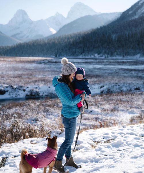
Discover the best times to explore Kananaskis with our seasonal highlights. Whether you’re chasing golden larch trees in the fall or enjoying snow-covered trails in the winter, each season brings a unique beauty and set of adventures to enjoy right from Mount Engadine Lodge. For more detailed information on what to do in Kananaskis in each season, check out our seasonal adventure guides.
Summer Wildflowers
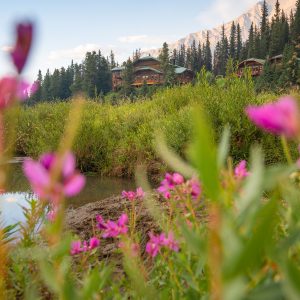
As the snow melts, the trails come alive with vibrant wildflowers, creating a stunning display in the alpine meadows. In the summer between mid-June to mid-August, keep your eyes peeled for a colourful array of blossoms along the trails, especially later in the season. Common species include alpine lupine, Indian paintbrush, fireweed and columbine. If you’re looking for wildflowers, check out areas like Chester Lake, Burstall Pass, and our very own Mount Engadine Meadows.

Summer Adventures
Summer is the perfect time for exploring the beautiful turquoise glacier-fed lakes and hiking to scenic viewpoints like Blackshale Suspension Bridge. The warm weather allows for a variety of outdoor activities, including mountain biking at Spray Lakes, family-friendly hikes like Burstall Pass, challenging trails like Tent Ridge, the and swimming in Watridge Lake for the brave! See our Summer Activities Guide for more information.
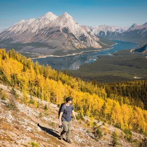
Autumn Larches
Experience breathtaking golden larch trees in the autumn. Late September to mid October is the best time to witness this stunning transformation as the landscape bursts with vibrant colours. Check our our special guide for the best larch hikes in Kananaskis to ensure you don’t miss out on this special time of year!

Snowy Adventures
Winter transforms Kananaskis into a snow-covered paradise, ideal for winter hiking and snowshoeing, fat-tire biking and cross-country skiing. Areas like Chester Lake and Mount Engadine Meadow become winter hiking wonderlands, offering picturesque views of serene and snowy landscapes. In Kananaskis, the snow often starts piling up enough to snowshoe between November to April, and you’ll often encounter snow on higher elevation trails until as late as mid-June. See our Winter Activities Guide for more information.
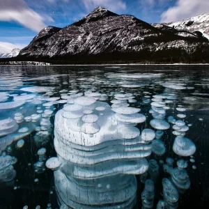
Frozen Methane Bubbles
A rare phenomenon that occurs in Alberta lakes in winter when water-dwelling bacteria feed or decaying organic matter and expel methane gas, and then the water freezes, suspending large white bubbles in the ice. This spectacle is most commonly seen between mid-January to mid-February. The key is to catch it when the lakes are not covered in snow. Two of the best spots to see this phenomenon in Kananaskis are at Spray Lakes and Barrier Lake (as photographed by the well-known local photographer Paul Zizka).
Hiking Gear Rentals at Mount Engadine
Mount Engadine is pleased to offer guests a range of hiking gear for rent, including trekking poles, snowshoes, shoe spikes, backpacks, bear spray and more. Click here to learn more about our on-site rental gear.

Tips for Hiking & Sightseeing in Kananaskis
Before heading out on your Kananaskis hiking adventure, it’s important to be well-prepared. From packing essentials like water and snacks to wearing the right clothing and understanding trail etiquette and wildlife safety, these hiking tips will help ensure a safe and enjoyable experience in the stunning backcountry surrounding Mount Engadine Lodge. If you have any questions, our knowledgeable and friendly staff are always available to help!
- What to Bring: Pack plenty of water, snacks, a map, sunscreen, a first-aid kit, and bear spray. If you need bear spray, you can rent some from the friendly front desk staff at Mount Engadine Lodge.
- Clothing: Dress in layers, including a moisture-wicking base, insulating middle layer, and waterproof outer layer. Bring sturdy hiking boots, trekking poles, and crampons or microspikes for winter hiking. Weather can change quickly in the Rockies, so pack extra layers and rain gear.
- Safety: Hike with a buddy and make sure someone knows where you are going and when you are expected to return (there is no cell service on most Kananaskis hikes). Stay on marked paths. Never try to approach or feed wild animals. Bears are common in the Kananaskis region, so always carry bear spray and be aware of your surroundings.
- Route Planning: Choose trails that match your skill level. Always check the weather forecast as well as the Kananaskis Trail Reports for trail conditions, wildlife advisories and closures before departing on your hike. If you need any help, ask our friendly staff during your stay and they will be happy to help you select the right adventure for you!
- Hiking Trail Etiquette: When taking breaks, step off the trail so others can pass. Downhill hikers yield to uphill hikers, and mountain bikers should ideally always yield to oncoming hikers on multi use trails. If nature calls, make sure you’re a good distance away from trails and water sources, and pack out or bury your waste.
- Environmental Awareness: Stay on designated hiking trails to avoid damaging sensitive ecosystems, do not litter, and follow “Leave No Trace” principles. Do not pick wildflowers or other vegetation.
- Kananaskis Conservation Pass: Purchasing a Kananaskis Conservation Pass is required for all visitors to the Kananaskis area to support park maintenance and conservation efforts. Purchase your pass online or from an in-person kiosk before parking in Kananaskis.
- Hiking with a Dog: Make sure to keep your dog on a leash at all times while in Kananaskis, and confirm that the trail allows dogs before you leave. While on a hike, your dog’s waste must be packed out our buried.
- Obey trail closures – Always obey trail closures. Trails can be closed for wildlife safety, to protect the trail from erosion when wet, and for various other reasons. Never adventure on a closed trail.
Looking for a basecamp for your Kananaskis hiking adventure? Consider an all-inclusive stay at our rustic mountain lodge, cabins, and glamping tents – with stunning views and hiking trails right at your doorstep.
